


MRF has now expanded its portfolio to also investigate and mitigate the bycatch of endangered sharks and rays. This builds on our extensive work with sea turtles and dugongs in Malaysia and throughout the Indo Pacific region. Under the Sabah Sharks and Rays Initiative 2019-2020, The Marine Research Foundation is undertaking two studies to inform policy and decision-making by the Department of Fisheries Sabah. One of these is investigating the effectiveness of Turtle Excluder Devices (TEDs) as possible shark and ray excluder devices, and the second is using electronic monitoring cameras to determine precisely where and when sharks and rays are captured by trawl fisheries based out of various ports in Sabah. This project is undertaken in collaboration with Leap-Spiral / Forever Sabah, WWF-Malaysia, Scuba Junkie S.E.A.S. and the Sabah Shark Protection Association, with funding support from the Shark Conservation Fund. Click here to follow our live interactive map for Sharks and Rays Bycatch in Sabah, Malaysia.
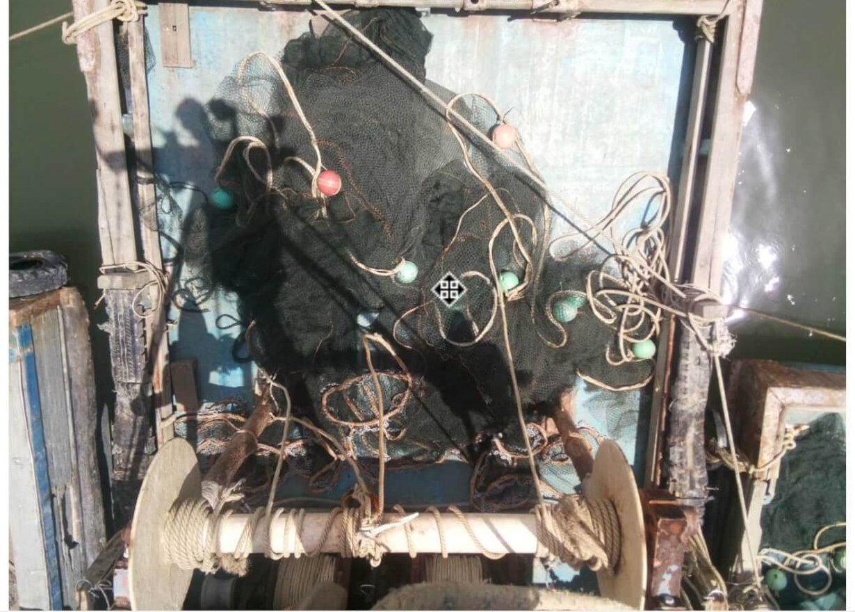
![]() Captures of sharks and rays in Sabah, whether targeted or accidental, has led to changes in species composition and abundance, and to fears of drastic population declines. Recent market surveys at major landing sites in Sabah record near-daily instances of shark and ray captures and landings, but little is known of the location of the interactions, the fishery gears responsible, and of captures that are not landed at the major markets. Sharks and rays are not necessarily high value catches, but they are retained and sold in markets.
Captures of sharks and rays in Sabah, whether targeted or accidental, has led to changes in species composition and abundance, and to fears of drastic population declines. Recent market surveys at major landing sites in Sabah record near-daily instances of shark and ray captures and landings, but little is known of the location of the interactions, the fishery gears responsible, and of captures that are not landed at the major markets. Sharks and rays are not necessarily high value catches, but they are retained and sold in markets.
Additionally, many small scale fishers in Sabah bring their catch back to their villages with small jetties, and any shark and ray captures from these fisheries remains unrecorded and unquantified. It is likely then that the total shark and ray capture figures are higher than fishery estimates suggest.
Sabah’s trawl fisheries operate in two main modes: benthic trawls for demersal fish and shrimp, and mid-water trawls for schooling fish. The former is likely responsible for the majority of ray captures and benthic sharks taken by trawlers, while the latter is likely responsible for captures of mid-water sharks taken by trawlers. There are, of course, multiple other fisheries, including the purse seine industry, the gillnet industry, and the longline industry. Gillnets also present one of the greatest challenges for management and mitigation of shark and ray bycatch due to the 1) generally unenforced nature of the fishery; 2) small sized-vessels that preclude observer programmes; and 3) remote locations and small numbers of boats at each location, making monitoring resource-demanding.

At present there are no observer programmes for fisheries in Malaysia. The cost of personnel, the trustworthiness of the reporting, and the small vessel sizes has largely precluded establishment of observer programmes in small scale fleets.
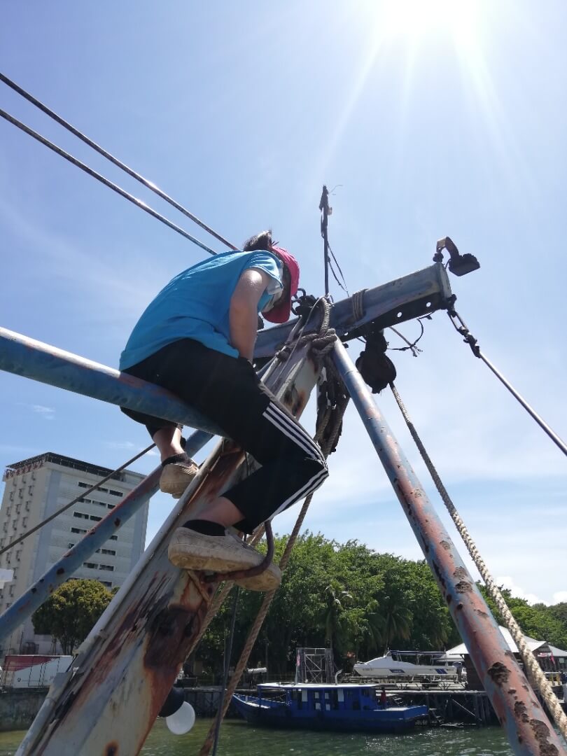
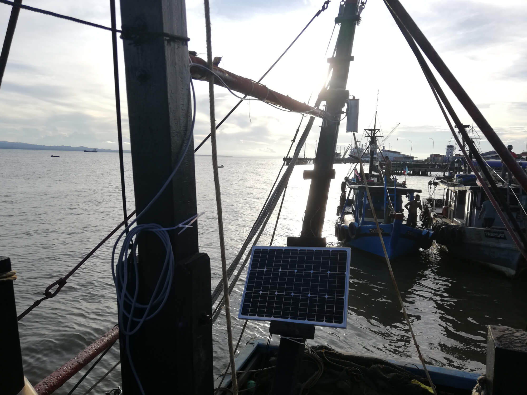
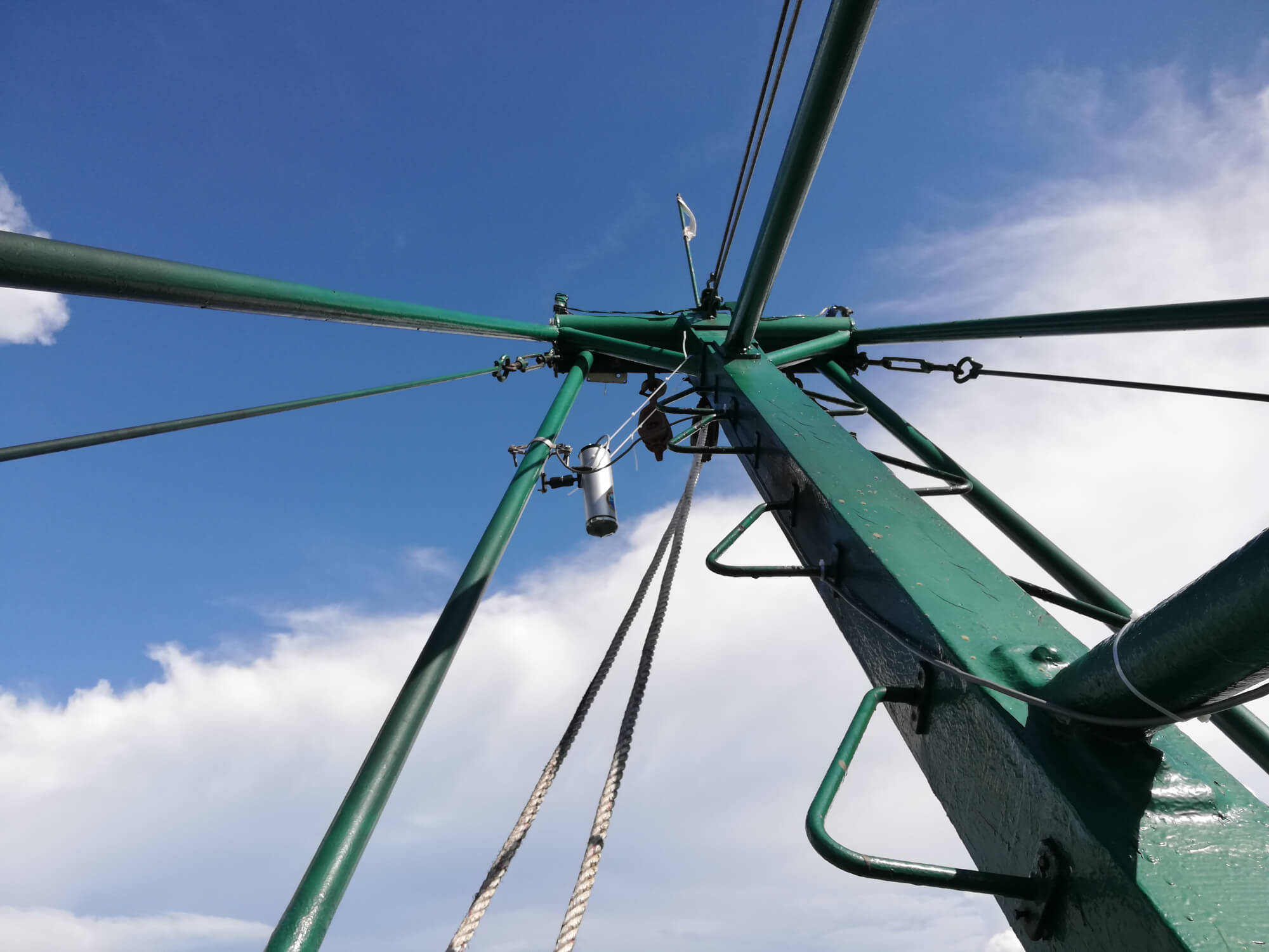
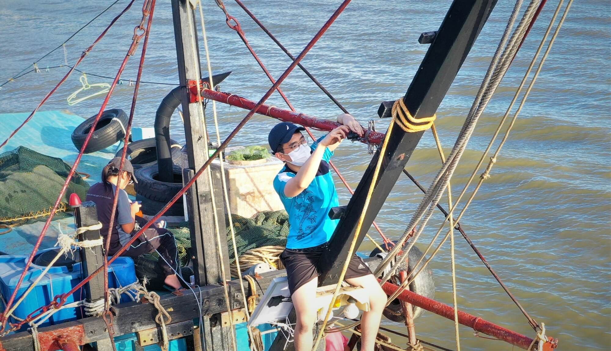
To start to address shark and ray captures in small scale fisheries and in industrial trawl industries we proposed to conduct a study to better understand the time and space relationships with bycatch of sharks and rays on trawl vessels – this may enable future management opportunities such as time-area closures – via the deployment of electronic monitoring systems (on-board, GPS-linked camera systems) on vessels.
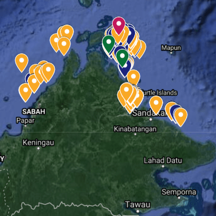
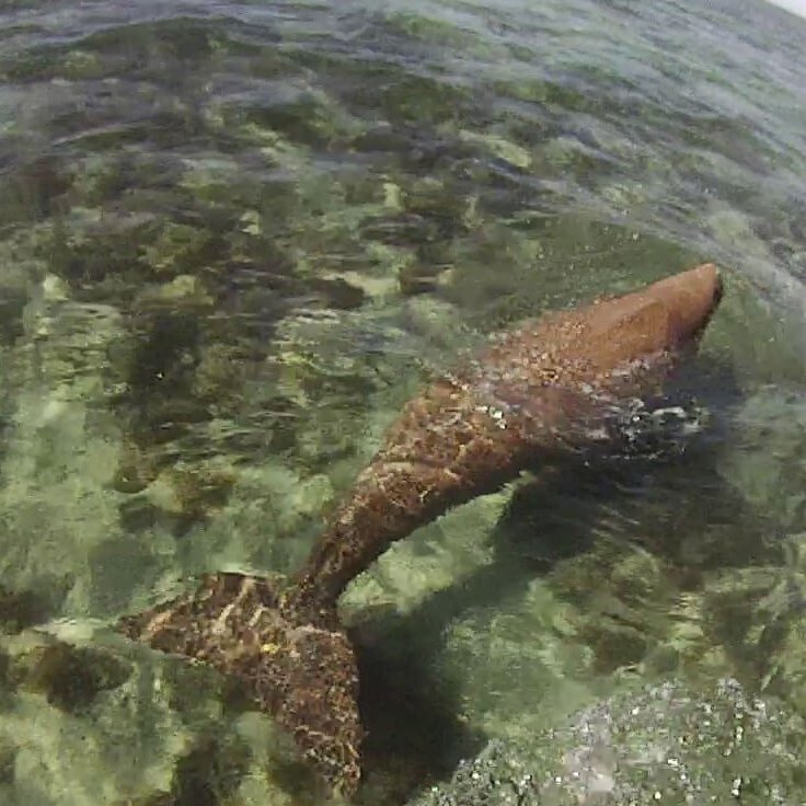
Data from the electronic monitoring cameras will provide the location and timing of captures of different rays and sharks, which might span over 300km given the wide geographical spread of traditional fishing grounds. Click here to view the actual images of sharks and rays bycatch captured by our cameras.
The electronic monitoring systems can replace human researchers and observers and studies have shown that a >90% species identification rate can be achieved. By careful location of the cameras we intend to capture video of the landings as they are brought on deck. The cameras are GPS-linked and thus can provide accurate location data for each capture. This means that we would know exactly where each species was being captured in space and time – providing an opportunity for time-area closures as a management measure.
The purpose of the study is to understand where and when sharks and rays are landed (If at all) by some of the trawlers operating out of Sabah. The data will be kept 100% anonymous and no vessel information would ever be shared. Data from the cameras (in the form of time-lapse films) will also be given to boat owners so that they can see what their boats are landing. This can be especially useful if owners ever wanted to tally what is landed with what is brought back to port, for instance…


